Aerial photography for architecture projects
Architects usually ask for one thing and mean four. The elevation, the massing in its context, the organisation of the site seen from above and the approach are four separate photographs with four different camera heights, and no single frame answers more than two of them.
An architectural brief that arrives as aerial photography of the project is almost never one request. Underneath it there are usually several, each of which the practice will use in a different document, and each of which the geometry treats differently. Separating them before anyone leaves the office saves a return visit, because the four pictures want the camera in four places and, more awkwardly, at four times of day.
The four are the elevation, the massing in context, the site organisation seen from close to vertical, and the approach. What follows is what each one needs.
- Elevation
- Camera at half the building height, sensor level
- Massing in context
- One and a half to two times the building height
- Site organisation
- Two to four times the height, looking steeply down
- Approach
- Thirty to eighty feet, along the route people walk
Four briefs, four cameras in four places
| Brief | Camera height | Lens | Light |
|---|---|---|---|
| Single elevation | Half the subject height | 35 to 50 mm equivalent | Sun raking across the plane, or flat overcast for a record shot |
| Massing in context | 1.5 to 2 times the height | 24 to 35 mm | Low sun, so neighbouring volumes separate by shadow |
| Site organisation | 2 to 4 times the height, steep | 24 to 35 mm | High sun, shadows short enough not to hide the plan |
| Approach | 30 to 80 ft | 50 to 85 mm | Dusk, or the first hour after sunrise |
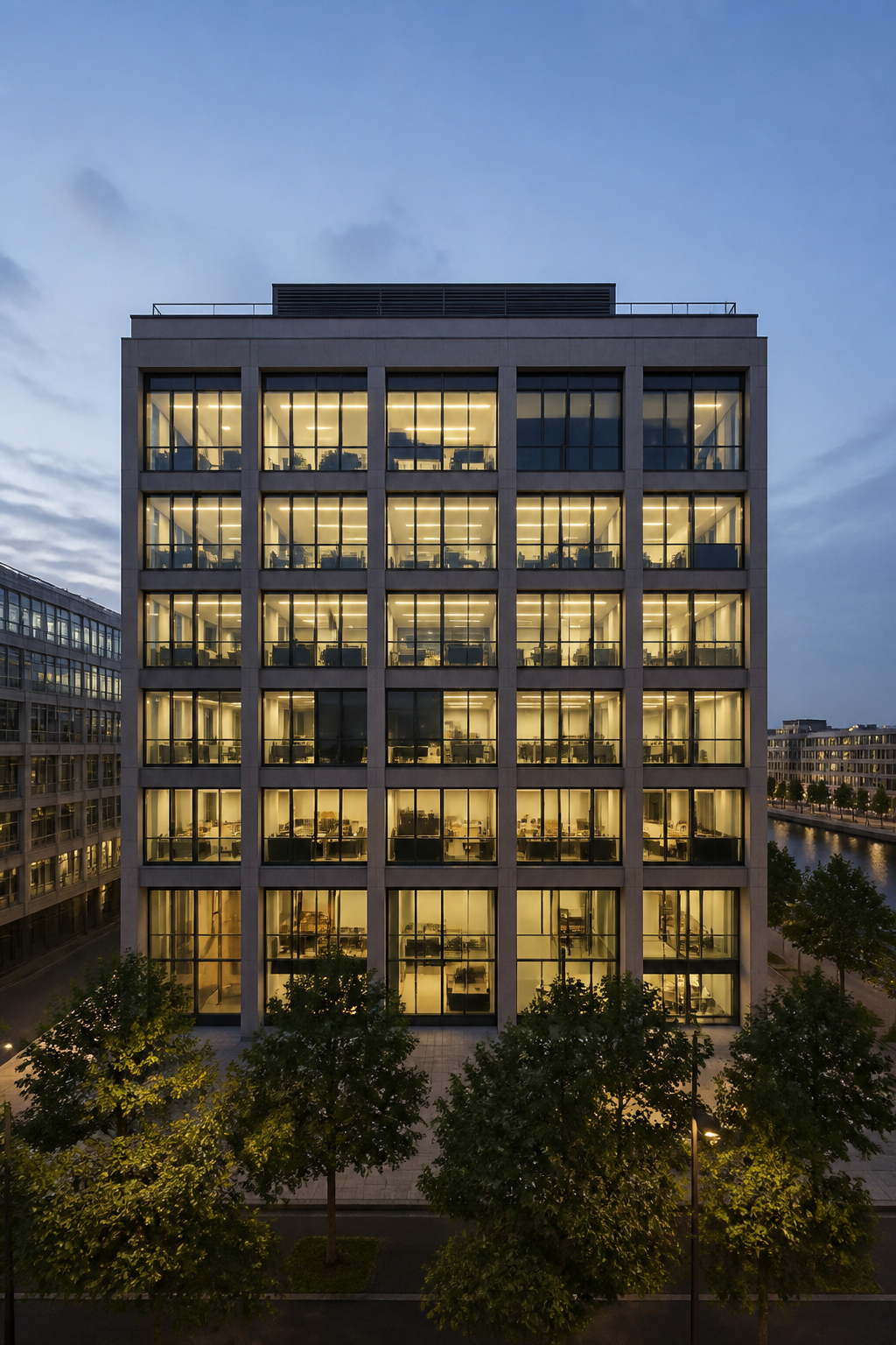
The elevation is the one that gets ruined most often, and always the same way: the camera was on the ground, it was tilted up, and the building leans backwards in the frame. Keeping the sensor plane parallel to the facade is the entire trick, and it forces the camera to half the subject height. That constraint, and the standoff arithmetic that comes with it, is worked through in the page on close range aerial perspective.
The photograph an architect keeps is rarely the highest one. It is the one taken from the height at which the building was designed to be understood.
On choosing an elevation
Context is a different picture, not a wider one
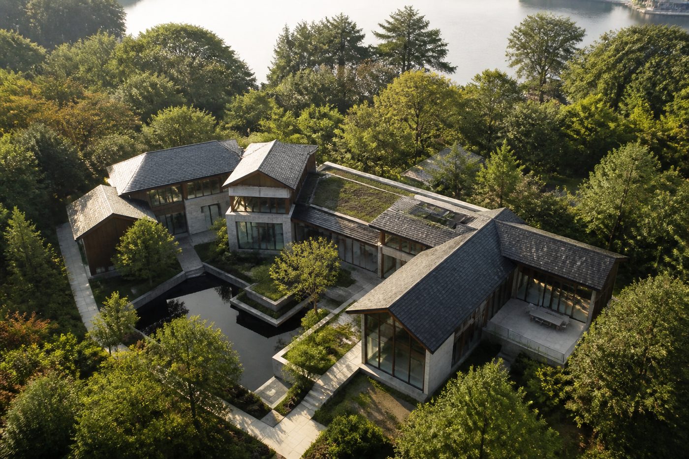
Massing shots exist to answer a question the elevation cannot: how does this volume sit against what was already there. That needs enough altitude to see over the immediate neighbours and enough shadow to tell the volumes apart, which means a low sun and a bearing chosen so the shadow of the new building falls across open ground rather than onto the facade you are trying to read. Altitude and sun bearing decide the same question on a natural surface: a lagoon read as bands of blue is the same choice applied to water instead of facades.
It is also the shot most likely to end up in a planning submission or a visual impact assessment, and those uses come with constraints that portfolio work does not have. Where a montage is to be produced, the photograph has to be documented: the exact position, the height above the datum, the bearing and the focal length, so that a three dimensional model can be matched to it afterwards.1 Public agencies that manage scenic resources maintain their own frameworks for this kind of assessment, and a project on federal land may be assessed against one.2
The roof is the drawing the client has never seen
A steeply inclined view of a finished project reads almost like the site plan, and it is frequently the image that surprises the design team, because it is the first time they see the plan they drew rendered in real materials, plant, parked cars and worn paths. Two practical notes. Shadows are the enemy here rather than the ally, so a high sun helps. And plant screening, which is invisible in every other photograph, becomes the dominant object in this one, which is worth warning the client about before the shoot rather than after.
If the deliverable is going to be measured rather than looked at, the request is not really a photograph. It is a photogrammetric survey producing an orthomosaic, in which every pixel has been reprojected to a single scale, and that is a different job with different accuracy requirements and different ground control.
Six questions worth asking before the shoot
- which drawing is this photograph standing in for, elevation, massing, plan or sequence;
- what is the subject height, so the camera height can be fixed rather than guessed;
- which facade matters, and therefore which hour of which day;
- is the image going into a submission, in which case what has to be recorded alongside it;
- is the site live, and if so who controls access and what is happening overhead;
- will anything be corrected in post, and does the intended use allow that.
Working over a building that is still being built
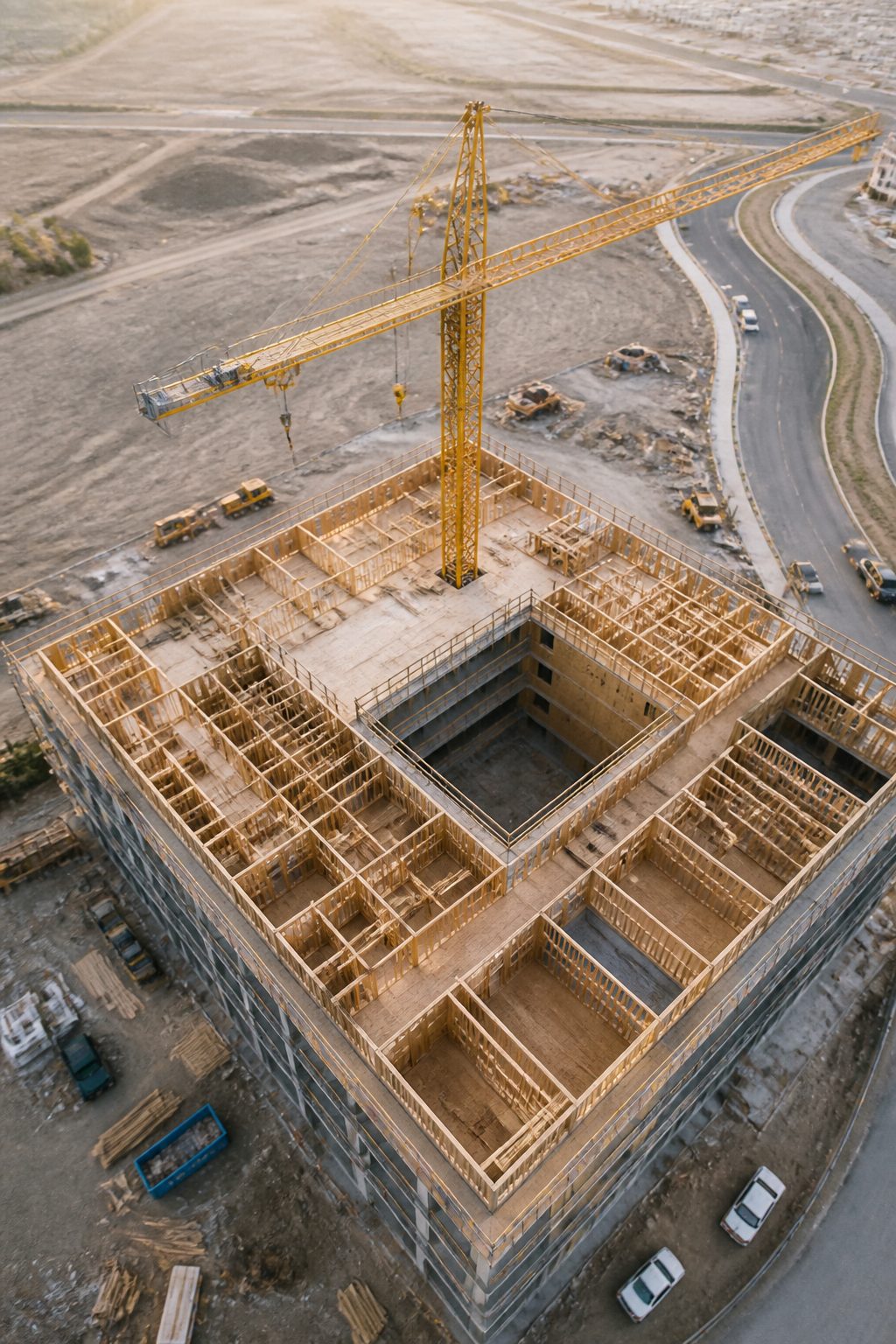
A project photographed before handover is a construction site with all that implies: controlled access, a site induction, cranes with their own slewing radius, and a schedule that moves. Two consequences follow for anyone planning aerial coverage. The first is that the photographic window is defined by the works, not by the light, so the shot list has to be ranked in case half of it is lost. The second is that the area beneath any aerial platform has to be cleared and kept clear, which on an active site means someone whose only job that hour is to keep it clear.3
Where the brief is documentation rather than a portrait, the discipline changes completely: the same station, the same lens, the same interval, month after month. That is a different craft and it has its own page.
Notes
- A montage can only be built on a photograph whose camera parameters are known. At minimum: position, height above a stated datum, bearing, focal length and sensor size, plus the date and time. Back
- The Bureau of Land Management operates a Visual Resource Management system that classifies public land by the degree of visual change permitted, and projects are assessed against the class that applies. Back
- Site specific safety requirements are set by the principal contractor and by occupational safety regulation, not by the photographer. This page describes practice, it does not state legal requirements. Back
- General observation, not legal advice. Rules on publication, privacy and property differ by jurisdiction and by contract. Back